|
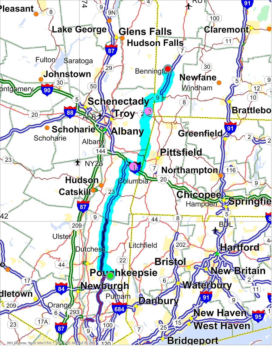
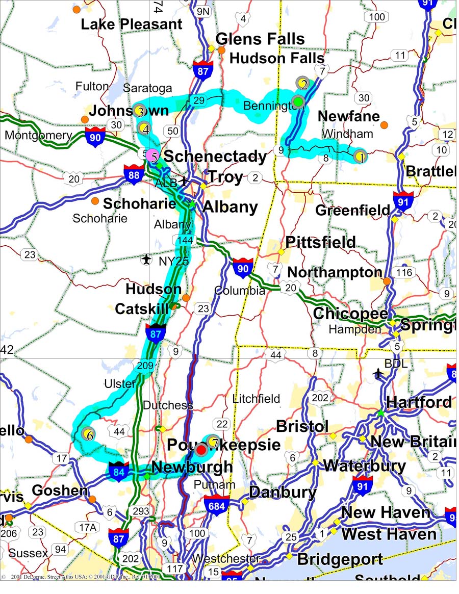
On Saturday morning, we left Arlington, drove south to Bennington, then east on Vermont 9 to just east of Wilmington to Hogback Mountain overlook (FN32ou) where we were ready by 1:00. We left Hogback around 4:00 local to drive back to Bennington and up route 7 north to Mt. Equinox (FN33kd). We operated on Mount Equinox from a bit after 5:00 until the road was closed at around 8:30 PM. Then back down to Arlington to the camper to grill some burgers and get a nights sleep to be up at 5:00, on the road by around 6:00 am local to head west over to Galway (FN23xb). In Galway, we go to the southeast corner of FN23 on one of the side roads off of Route 29. There are also several parking lots along Route 29 that look promising, but we haven't asked around for permission. This area was chosen because it is reasonably high (about 1000 feet) and not too much driving. We have thought about going up to the UMX repeater/beacon site, but have not checked it out. Have heard reports that it is not too great. After leaving Galway, we drive down 147 until we get into FN22xx. Still reasonably high at about 800 feet. From there, we get on the Thruway down to Kingston and down 209 to Ellenville for the trip up to Sam's Point (FN21tq). This is a good site for us, but be aware of two problems. 1.The road is now a private road (it used to be a toll road) and is closed to the public. We happen to have a contact and are usually able to get access. 2.Since the road was made private it has not been maintained. A lot of it is washed out with very deep ruts. I am VERY glad I have 4 wheel drive and 17 inch wheels for the trip up! If anyone wants to do some operating by parking at the parking lot and hiking a mile or so up the hill, it is a great spot but it does mean carrying all the "stuff" you need up the hill. From FN21 we go down to Interstate 84 and across to dutchess county. We then go up a local hill (Clove Valley) near home to end up in FN31ep. |
|
|
| The travels on Saturday and Sunday amount to 352 miles for a total of almost 500 miles. Still not a lot by some others routes, but along with all the operating time, enough to tire me out a bit. A really good nights sleep at home! In some past contests, we have done a similar route but the reverse. In that case, we looked for a good place to stay Saturday night (I am getting far too old to go with our a reasonable 7 hour nights sleep!). We found a great place in FN22 on route 23 in east Windham, Point Lookout Inn Pointlookout URL
It is at about 1900 feet and has a truly magnificent view of the New England hills. When we spend the night there, the Innkeeper allows us to operate from his parking lot. It is very open to the northwest, north and east, but obstructed to the southeast, south, and west. There is also a public overlook not far east of there that is also open to the east.
|
|